In short: Groundwater monitoring measures the quality and level of groundwater over time through a network of monitoring bores. It underpins contaminated land management, landfill compliance and EPA licence conditions — showing whether contamination is present, whether it is moving, and whether it is getting better or worse.
What is groundwater monitoring?
Groundwater monitoring is the systematic measurement of groundwater level and quality over time, using a network of purpose-built monitoring bores (also called monitoring wells). Where a single sampling round gives a snapshot, monitoring gives a moving picture: it reveals how groundwater conditions change with the seasons, whether a contaminant plume is stable, shrinking or spreading, and whether management or remediation is working.
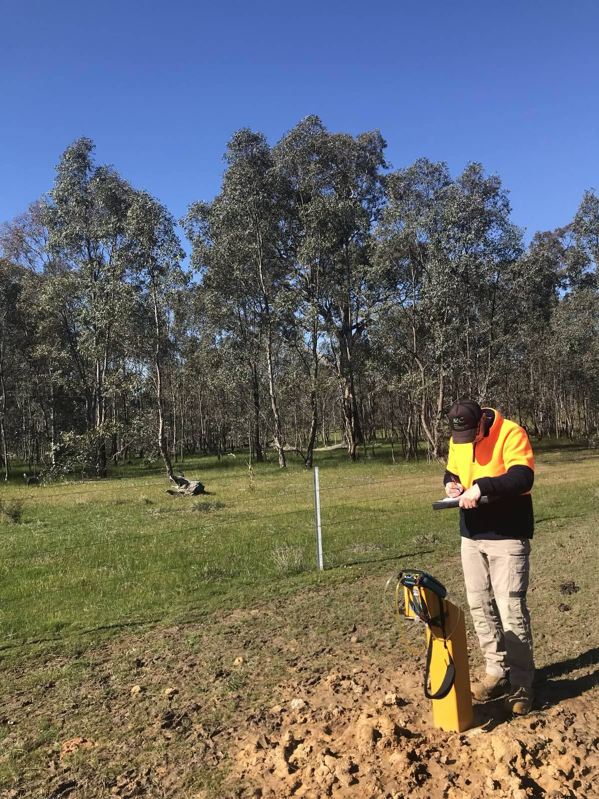
Each round of data collection is a groundwater monitoring event (GME). During a GME, an environmental scientist gauges the standing water level in each bore, purges stale water from the well, records field parameters such as pH, electrical conductivity, dissolved oxygen and redox potential, and collects samples for NATA-accredited laboratory analysis. Repeated over a series of events, the data allows contaminant concentrations, groundwater flow direction and long-term trends to be assessed against recognised guidelines.
Groundwater monitoring is a natural continuation of contaminated land work. It frequently follows a Detailed Site Investigation where groundwater impact has been identified, and it draws on the same groundwater considerations that shape a Land Capability Assessment on sensitive or low-lying sites.
When is groundwater monitoring required?
Groundwater monitoring is required or recommended in a range of settings across the region. The common drivers are:
- Contaminated sites — to define and track contamination in groundwater, and to confirm that a plume is stable or responding to management;
- Landfills — where regular monitoring of surrounding bores is used to detect any leachate impact on groundwater;
- EPA licence conditions — many licensed premises are required to monitor groundwater to set schedules and report the results;
- Development approvals — where a consent authority requires groundwater to be characterised or monitored as a condition of approval;
- Ongoing environmental management — for industrial sites, service stations, and rural or agricultural operations that need to demonstrate their groundwater is being managed responsibly.
For operators and landholders around Albury, Wodonga, Wangaratta, Benalla and Shepparton, a well-designed monitoring programme is both a compliance obligation and a source of reassurance — clear evidence that groundwater is being looked after.
Consistency is everything in monitoring. Sampling the same bores, with the same method, at the same times of year, is what makes a trend meaningful. A programme that changes its approach every event produces data that is hard to interpret and easy to challenge.
Monitoring bore networks and design
A monitoring programme is only as good as the network it draws on. Designing that network starts with a conceptual site model — an understanding of the geology, the depth and direction of groundwater flow, the likely source of any contamination, and the sensitive receptors (bores, waterways, ecosystems) that could be affected.
A typical network includes at least one bore upgradient of a potential source, to establish background groundwater quality, and several downgradient bores positioned to detect and delineate any impact along the flow path. The number, spacing and construction of the bores are matched to the site rather than taken from a template. Bores are constructed with appropriately screened intervals, developed to ensure they yield representative water, and surveyed so that water levels can be converted to a consistent datum and a groundwater flow direction derived.
Because we have in-house environmental drilling capability, we can install and develop monitoring bores as well as run the ongoing events. Handling both means the network is built for the monitoring objectives from the outset — and it keeps mobilisation, quality control and timing under one team across sites in southern NSW and north east Victoria.
Groundwater monitoring events — sampling and analysis
Each groundwater monitoring event follows a documented, repeatable procedure so that results are comparable from one round to the next. A typical event involves:
- Gauging — measuring the standing water level (and any separate-phase product) in each bore before disturbance;
- Purging — removing stagnant water from the well so that the sample is drawn from the surrounding aquifer, monitored until field parameters stabilise;
- Field parameters — recording pH, electrical conductivity (EC), dissolved oxygen (DO), redox potential and temperature during purging;
- Sampling — collecting groundwater into the correct containers, with appropriate preservation, for the agreed analytical suite;
- Quality control — collecting field duplicates and rinsate blanks and following chain-of-custody procedures to the laboratory.
Samples are submitted to a NATA-accredited laboratory for analysis of the parameters relevant to the site — which may include dissolved metals, hydrocarbons (TRH and BTEX), PAHs, nutrients, major ions and, where warranted, PFAS. Careful field technique matters: correct purging and sampling are what separate a defensible result from a misleading one.
Interpreting results
Data only becomes useful once it is interpreted. Laboratory results are compared against the groundwater investigation levels in the National Environment Protection (Assessment of Site Contamination) Measure — the ASC NEPM 1999, as amended in 2013 — together with other relevant guidelines, with the applicable criteria selected according to the beneficial uses of the groundwater (for example drinking water, stock watering, irrigation or aquatic ecosystem protection).
Beyond simple exceedances, interpretation looks at the shape of the problem over space and time:
- Plume extent — where contaminant concentrations sit across the network, and whether the plume is bounded;
- Trends — whether concentrations at each bore are rising, stable or declining across successive events;
- Flow direction — derived from surveyed water levels, to confirm which bores are genuinely upgradient and downgradient;
- Seasonal variation — the influence of rainfall and recharge on both water levels and quality.
This is where regional experience counts. The groundwater systems around the Murray, Ovens, Kiewa and Goulburn — and the aquifers beneath the region's towns and rural land — each behave differently, and interpreting results in that context is what turns numbers into meaningful advice.
Regulatory reporting
Most monitoring programmes exist to satisfy a regulator, so clear reporting is central to the service. In New South Wales, groundwater obligations commonly arise under the Protection of the Environment Operations Act 1997 and EPA NSW licence conditions; in Victoria, they arise under the Environment Protection Act 2017 and EPA Victoria requirements. Landfills, licensed industrial premises and sites under a management order frequently carry specific monitoring schedules and reporting formats.
We prepare monitoring reports that present the data clearly — tabulated results against the adopted criteria, water level and concentration trends, groundwater contour plans, and a plain-English interpretation — in a form suited to the relevant NSW or Victorian regulator. Where results warrant it, we set out recommendations, whether that is a change to monitoring frequency, additional investigation, or steps toward management or remediation. Being based on the border, we prepare reporting to suit either jurisdiction, so a project that spans both states is handled by one team.
Our field and drilling capability
Reliable monitoring depends on reliable fieldwork. Jones Environmental runs its own in-house environmental drilling and field capability, which means we can install monitoring bores, develop them, and carry out every monitoring event without relying on third-party crews. That control brings real advantages: faster mobilisation to sites across the region, consistent field technique from one event to the next, and tighter management of quality and chain of custody.
It also means the people in the field understand the purpose of the programme. Our scientists know why a particular bore matters, what a change in a field parameter might signal, and when something on site warrants a closer look — judgement that a purely mechanical sampling service cannot offer. For clients in Wodonga, Wangaratta, Yarrawonga, Corowa, Mulwala, Howlong and Holbrook, that translates into dependable data and monitoring rounds that run to schedule.
Why choose Jones Environmental Consulting
Jones Environmental Consulting is an owner-operated environmental consultancy based in Albury Wodonga, on the NSW–Victoria border. Groundwater monitoring is core business, and every programme is overseen by a qualified environmental scientist.
Patricia Jones, our Principal Environmental Scientist and Director, brings around two decades of environmental consulting experience across contaminated land, groundwater and waste for local government, state agencies, developers and landholders. Russell Jones, Senior Environmental Scientist and Field Operations Manager, has around fifteen years of field experience and runs our in-house drilling and monitoring capability — so the network your programme relies on is designed and built by the same team that samples it.
Clients choose us because we offer:
- End-to-end capability — bore design and installation, monitoring events, laboratory coordination and reporting under one roof;
- In-house drilling — faster mobilisation and consistent field technique across every event;
- Regulatory fluency on both sides of the border — NSW and Victorian requirements handled by one team;
- Sound interpretation — results assessed against NEPM groundwater investigation levels with genuine regional context;
- Direct senior involvement — you deal with the scientist doing the work, from network design to final report.
Whether you are managing a contaminated site, meeting a landfill or licence condition, or satisfying a development approval, we can design and run a monitoring programme that stands up to scrutiny. Where monitoring points to a wider issue, our contamination assessment service can address the site as a whole. To discuss a programme, get in touch for a fixed-fee quote and a realistic schedule.